| Alabama | 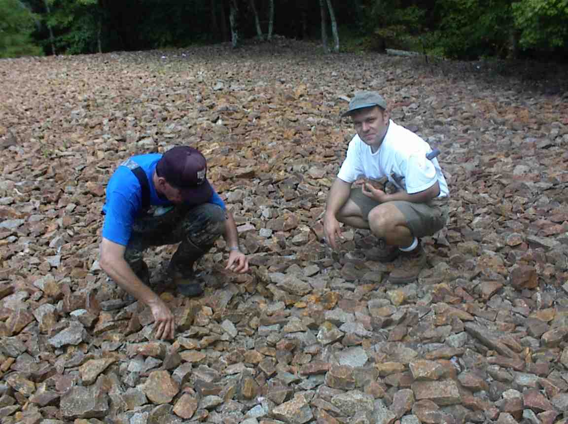 |
| |
Alabama Gold James A. Mallonee Labor Day John Martin, David Moody (Iris gave him my
number), and I labored to find the Hog Mountain Gold Mine. The mine is
unusual for Alabama, in that the gold occurs finely disseminated in
granite instead of schist. It was the only mine in Alabama that used
cyanide to process the ore, something that is done in about 80
percent of current mining operations. Solutions of sodium cyanide are sprayed over the crushed ore, and the gold
enriched solutions are collected at certain points under the
pile. The enriched solution is then filtered to separate out the gold,
and then the remainder is sprayed back over the heap to start the process
again. Cyanide is common in nature; it is what causes peach pits and
cherry pits to be poisonous (amygdaline). For anyone who is interested I have information on using this method for small lots
of gold using quart jars up to a cement mixer. The Hog Mountain Mine
(also known as the Hillabee mines or Hogback Mine) was opened sometime in the
1840's. At that time, ore was hauled from the mine to a small creek below
with oxen. By 1889, there were two stamp mills in operation. The mine closed in 1916 when on account of the World War,
cyanide could not be obtained and labor was drawn away into military service or employment at
greatly increased wages. The mine is located just west of
the town of New Site at Lat 330421N Long 0855105W or Sec 10 and 15, T 24 N, R
22 E. There is a road just east of a small township of Cowpens, which
leads north in the direction of the mine. We missed the paved road and
took a gravel road beside a small church, which also leads to the mine
road. The area just before we reached the mine had recently been
clear-cut and the road itself has been improved with loads of gravel.
Although we knew we were in the correct area, we had no idea which road led to
the mine, so we drove around a little bit before we found the first
shaft. The entire hillside has various holes, pits, and shafts where the
miners followed the ore bodies. According to John, the ore was mostly in
a quartz vein, however according to the geological report the quartz vein was
the least productive. We found one shaft, about 30 feet down that we
could enter from the top of the hill. The tunnels at the bottom of the
shaft are not very long before they are collapsed. The sides of these
tunnels had been "smoothed" with water, although no water could be
seen. We collected some samples from the quartz vein and sides of the
vein that was above our heads. I made sure that I moved toward the
entrance before John started hammering on it. After leaving that tunnel,
we walked around to several other tunnels, although most of them had collapsed
or been filled in. According to John, there were two main levels one at
the 100-foot level and another at the 200-foot level. After wondering
around for some time, we looked over the site of the stamp mill(s) and the mine
dump. You could still clearly see the concrete walls and floors of the stamp
mill. The mine dump is a large area covered with granite and
quartz rock, most of it about the size of a large brick. There is a
slight smell of sulfur where the pyrite had decomposed, and some of the rocks
have a rusty stain. We picked up some representative rocks from the
pile, going mainly for those that showed some promise of being
"different". According to the reports, this pile
represents part of almost 500 tons of rock removed from depths of 100 to
200 feet down. If the geologic survey report is
correct, samples taken at random from this rock pile have
yielded values of $58.67, $6.20, $10.53, and $22.73 per
ton (at $20/ounce). Considering that modern miners believe
values of 1 ounce per 5 tons or less is paying, then this rock
pile may be worth quite a bit. We also stopped near Hillabee Creek, which passes under
Alabama Highway 22 just north of Alexander City and attempted to pan for
gold. To be more accurate, we didn’t
want to park beside the bridge, so…we walked about a half-mile down a blocked
county paved road, then hiked cross-country until we found the stream and I
jumped down a 6-foot vertical drop into some bushes and crawled down to the
stream… The water is really down in the
stream, and you can easily get to the bedrock.
However, the main part of the stream is buried under piles of large
rocks and gravel. It looked very good
for panning, since the “Hillabee Schist” tilts upwards like the riffles in a
sluice box and should catch any gold.
However, I only found one small flake after digging a 2-foot deep hole
in the middle of the gravel and rocks.
The gold settles somewhere upstream from where I was panning, or there
really is only a small amount of it.
There are other heavy materials in the sand, including small garnets and
black sand, but not large quantities of either. There are no famous gold locations along this stream, however the
“look” of the place was promising. |